⛰️ Burroo Ned (Bradda Head, 700ft)
Multi-Period Archaeological Site HIGH Priority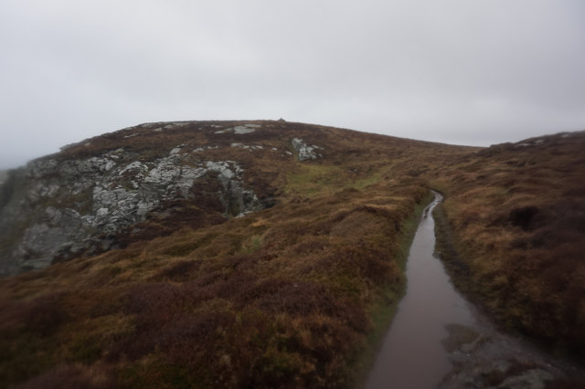
Dramatic headland above Port Erin with the Milner Tower (Victorian folly) on top. Bradda Head is historically significant for MINING — Durham's 1595 map marks 'Min Hugh' (Mine Hough) here, noting lead ore 'near unto the sea' that 'holds much silver.' Governor Edward Christian experimented with the mines in the 1630s. The ore veins are visible in the cliff face. WHY: (1) Mining since at least the 1600s = 400+ years of miners' lost items on the hill, (2) The Milner Tower (1871) attracted Victorian tourists = coins, (3) Bradda Head is a dramatic promontory — Iron Age people fortified promontories, (4) The ore veins attracted prospectors from EVERY period, (5) The coastal path from Port Erin to Fleshwick is walked by thousands annually. The hilltop plateau around Milner Tower, the old mine workings, and the approach paths are all productive.
What You Can Find Here
Mining tools/tokens, Victorian tourist coins, possible Iron Age items, mineral specimens
Access Information
✅ Public — Raad ny Foillan coastal path
Best Season to Visit
Year-round
📍 54.06°N, 4.758°W · Isle of Man
📍 View on Interactive Map 🌍 Google Maps