⛰️ South Barrule Hillfort (1,585ft)
Iron Age Hillfort & Settlement HIGH Priority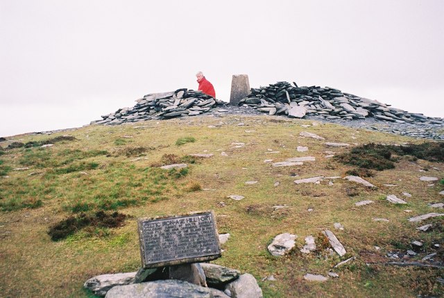
THE LARGEST HILLFORT ON THE ISLE OF MAN. South Barrule (1,585ft) has the remains of approximately 70 hut circles within its defensive walls — making it a MAJOR Iron Age settlement, not just a defensive position. The fortification walls are clearly visible. This was essentially a hilltop town. WHY: (1) 70 hut circles = a large permanent population generating enormous amounts of lost/discarded material, (2) The defensive walls suggest conflict — weapons, armour fragments, sling stones, (3) Hillforts were also MARKETS and ASSEMBLY places — people from lowland farms came up to trade, (4) South Barrule has religious significance — 'Barrule' may derive from 'Ward-fell' (watch hill), (5) The fort was occupied for centuries, accumulating material from Iron Age through Early Christian. The slopes BELOW the fort walls are often more productive than inside — material washes downhill over millennia.
What You Can Find Here
Iron Age pottery, bronze items, sling stones, dress fasteners, coins, tools
Access Information
✅ Public footpath from Round Table
Best Season to Visit
Summer (hill access)
📍 54.134°N, 4.67°W · Isle of Man
📍 View on Interactive Map 🌍 Google Maps